Civil Engineering Joint Stock Company No.585


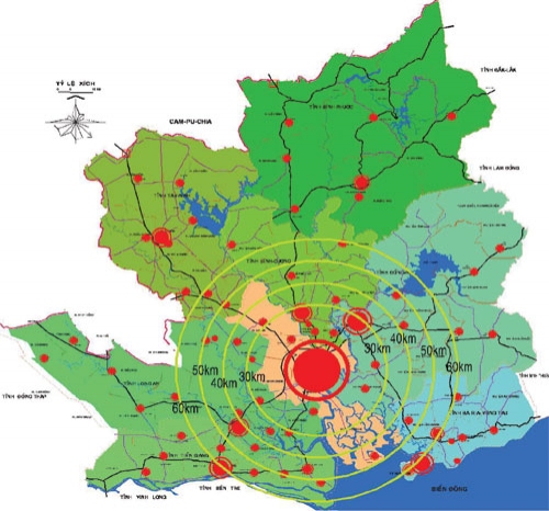
Planning for Ho Chi Minh City with four subregions covering 8 provinces
05.01.2018 - The Prime Minister has approved the adjustment of construction planning of Ho Chi Minh City up to 2030 with a vision to 2050 with the total area of about 30,404 km2
Ho Chi Minh City covers the whole administrative boundary of Ho Chi Minh City and the neighboring provinces of Ba Ria - Vung Tau, Binh Duong, Binh Phuoc, Tay Ninh, Long An, Dong Nai and Tien Giang. ,
By 2030, the land for urban construction will reach about 270,000 - 290,000 ha, on average of 100-150 m2 / person. Land for construction of rural population quarters shall reach around 150,000 - 170,000 hectares by the year 2030, with the average population of 180-210 m2 / person.
Estimated area of land for construction of industrial parks until the year 2030 is about 69,000 hectares, including 7.080 hectares in Ho Chi Minh City, 13,400 hectares in Dong Nai province, 9,210 hectares in Ba Ria - Vung Tau province, 14,790 hectares in Binh Duong province, 5.185 hectares in Tay Ninh province 8,220 ha in Binh Phuoc, 13,500 ha in Long An, 3,200 ha in Tien Giang province.
Ho Chi Minh City is divided into sub-regions and has the following development orientations:
Suburban center: Including Ho Chi Minh City and surrounding areas including districts, cities and towns: Duc Hoa, Can Giuoc, Ben Luc (Long An); Thu Dau Mot, Di An, Thuan An, Ben Cat, Tan Uyen (Binh Duong); Bien Hoa, Nhon Trach, Trang Bom, Long Thanh and some parts of Vinh Cuu (Dong Nai); Among them, Ho Chi Minh City is the central nuclear core area; Binh Duong is a dynamic city in the North, Bien Hoa City - Long Thanh - Nhon Trach is an urban motive force in the East. Cu Chi - Hau Nghia - Duc Hoa urban centers are the motive urban areas in the northwest. Ben Luc - Can Giuoc - Hiep Phuoc urban centers are the eco-urban areas in the southwest. Covering an area of 5,164 km2, the population is projected to reach 15.7 million by 2030. The rate of urbanization in 2030 is about 85-90%.
The central sub-region is located at the center of the whole region and has a high rate of urbanization; Highlighted with strengths in hi-tech and specialized industry, training, healthcare, international trade connectors. Spatial development in the East and Northeast, building a model of urban compression and adaptation to climate change. To organize a synchronous transportation system, to increase green spaces along Sai Gon and Dong Nai rivers; maintain and develop green corridors to reduce the risk of flooding; Can Gio Biosphere Reserve.
Eastern subregion: Including Ba Ria - Vung Tau province and the rest of Dong Nai province (Long Khanh town and districts of Thong Nhat, Cam My, Xuan Loc, Dinh Quan, Tan Phu, Vinh Cuu district). ). In particular, Vung Tau and Ba Ria are the growth poles on the economic corridor along Highway 51; Long Khanh town is the growth pole on the economic corridor along Highway 1A. Covering an area of 6,266.5 square kilometers, the population is expected to reach 2,838,000 in 2030. The rate of urbanization to 2030 is about 55-60%.
The eastern sub-region serves as a gateway for international trade of the whole region and the country through Long Thanh International Airport and international seaport Cai Mep - Thi Vai. To focus on industrial development (oil and gas, port, auxiliary and multidisciplinary industries), agriculture (high technology, specialized farming, exploitation and aquaculture). To enhance the functions of intermediate services, warehousing and forwarding of national and international transports in association with the ports, international airports and ports. To develop ecotourism and eco-tourist tourism. Conservation of landscape of natural forest, ecological area of salt water and Tri An reservoir.
Northern-Northwestern subregion: Including Binh Phuoc province, Tay Ninh province and part of Binh Duong province (Bau Bang district, Dau Tieng, Phu Giao, Bac Tan Uyen). Chon Thanh - Dong Xoai urban area is the growth pole on the economic corridor along National Highway 13. Trang Bang - Go Dau - Hoa Thanh - Tay Ninh is the growth pole on the Northwest corridor along the National Highway. Highway 22. Area of 13,087 km2, the population forecast in 2030 about 3.565 million people. The urbanization rate will be 40-45% by 2030.
As the northern-northwest trade gateway of Ho Chi Minh City that links the Greater Mekong and Southeast Asia region, the North-Northeast sub-region has developed remarkably in multidisciplinary industry, Processing agricultural and forest products, planting industrial crops and applying hi-tech agriculture. Strengthening the functions of trade - services, cultural and historical tourism and ecotourism. Maintain and protect forest ecosystems and protect water resources, ensuring ecological balance for the whole region.
The southwestern region: Including Tien Giang province and part of Long An province (except Duc Hoa, Can Giuoc, Ben Luc). In which My Tho City, Tan An City is the growth pole on the corridor along National Highway 1 southwest. An area of 6,075 km2, the population forecast in 2030 about 2.897 million people, in 2050 about 3.410 thousand people. The urbanization rate will be 35-40% by 2030.
As the gateway of Ho Chi Minh City to the Mekong Delta and the Mekong River region, the southwestern subregion develops mainly in the agricultural, port industry; research on biotechnology at national level; agriculture specializing in rice cultivation, fruit trees, aquaculture and applied agriculture
Cafeland.vn
Related news
- Công nghiệp là lĩnh vực bị tác động nặng nề nhất của kinh tế Việt Nam
- Giảm áp lực cho Doanh nghiệp bất động sản khó tiếp cận vốn
- Doanh nghiệp bất động sản vất vả với bài toán kinh doanh
- Bất động sản phát mãi cũng tiềm ẩn một số rủi ro
- Người nước ngoài được sở hữu nhưng không gắn với quyền sử dụng đất khi mua nhà ở tại Việt Nam
- Luật Quy Hoạch Đô Thị Việt Nam Năm 2023
- Nghị Quyết 33 Thúc Đẩy Tháo Gỡ Về Chính Sách
- Người Mua Nhà Lựa Chọn Các Chủ Đầu Tư BĐS Uy Tín Trên Những Tiêu Chí Nào?


